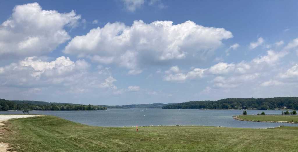
Atwood Lake, above, is one of the MCWD’s 10 permanent lakes formed for flood control and water conservation. (Credit: Ken Drenten)
By Ken Drenten
Ohio is home to a chain of beautiful reservoirs and parks that began with a tragedy on a broad scale.
In March 1913, Ohio experienced what remains the state’s worst weather-related disaster, the Great Flood of 1913. Across the state, up to 11 inches of rain, along with snow runoff, fell in a three-day period, causing every stream, creek and river in the state to flood.
In Ohio, an estimated 470 people died and millions of dollars of damage was done. Across the East and Midwest, 900 people died and at least $750 million in damage was done.
The Great Miami, Muskingum and Scioto rivers in Ohio rose to record levels, wiping out roads, canals and bridges and inundating homes and businesses in small towns and large cities.
The disaster spurred the development of watershed conservancy districts in Ohio with the passage of the Conservancy Act of 1914. On June 3, 1933, 20 years after the Great Flood, the Muskingum Watershed Conservancy District (MWCD) was established.
The MWCD spans all or portions of 27 counties and 8,000 miles of watershed, where a coordinated system of dams and reservoirs provide flood reduction, water conservation and recreational benefits.
The flood reduction system has been credited by the federal government with saving an estimated $10 billion worth of potential damage from flooding in the Muskingum River watershed, which includes its three main tributaries, the Tuscarawas River, Walhonding River and Wills Creek.
Most people know these reservoirs for the recreational opportunities they afford. The lakes are popular for fishing, boating, camping and many other outdoor recreational activities. Most notably, the lakes are well-known for catches of muskie, pike, saugeye, walleye, bass, crappie, bluegill and other species.
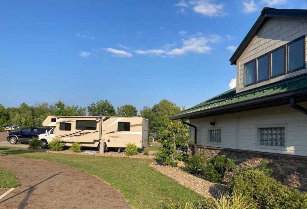
Atwood Lake Park’s campground features many full hook-up sites, modern restrooms and shower facilities. (Credit: Ken Drenten)
The 10 permanent lakes and parks operated by MCWD are:
Atwood Lake Park – 2,500-acre land area, 1,540-acre lake with 28 miles of shoreline, beach, 500-plus site campground, camp store, shower houses, cabins, three public boat launch ramps, activity center, nature center, picnic shelters, biking/walking paths; 9500 Lakeview Road, Mineral City (330) 343-6780.
Beach City Lake – 930-acre land area, 420-acre lake; hunting, limited boating, no launch ramps; camping not permitted. Located in northern Tuscarawas, southern Stark counties near SR 21, 250 and 93 near the town of Beach City.
Charles Mill Lake Park – 2,000-acre land area, 1,350-acre lake with 34 miles of shoreline, two campgrounds with more than 400 sites, cabins, swimming beach, camper’s swimming pool, recreational courts, hiking trails, picnicking. 1277A Ohio 430, Mansfield (419) 368-6885.
Clendening Lake – 1,700-acre lake with 40 miles of shoreline, 80-site campground, cabins, marina, two public boat ramps. 79100 Bose Road, Freeport (740) 433-4858.
Leesville Lake – 2,700 acres of land area, 1,000-acre lake, two campgrounds, two privately owned marinas, boating, fishing, hiking. 4131 Deer Road SW, Bowerston (330) 343-6780.
Piedmont Lake – 4,416 acres of land area, 2,270-acre lake, 38 miles of shoreline, campground, cabins, two public boat launch ramps, fishing, boating, hiking. 32281 Marina Road, Freeport (740) 433-4847.
Pleasant Hill Lake – 1,350 acres of land, 850-acre lake, 400-plus site campground, cabins, marina, swimming beach, activity center, sports courts/fields, fishing, boating, hiking, picnicking. 3431 SR 95, Perrysville (419) 938-7884.
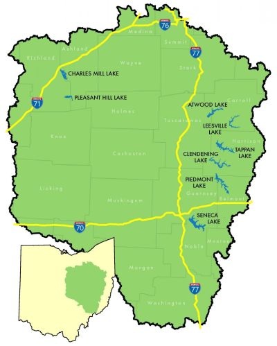
Locations of Muskingum Watershed Conservancy District lakes. (Credit: MCWD.org)
Seneca Lake – 4,060 acres of land, 3,550-acre lake, 500-site campground from primitive to full hookup, cabins, marina, public boat launch ramp, picnicking, swimming beach, boating, fishing, splash pad, hiking. 22172 Park Road, Senecaville (740) 685-6013.
Tappan Lake – 5,000 acres of land, 2,350-acre lake, campground with more than 550 sites, cabins, rental RVs, boating, fishing, marina, boat launch ramp, camp store, picnic shelters, activity center. 84000 Mallarnee Road, Deersville (740) 922-3649.
Wills Creek Lake – 2,830 acres of land, 900 acres of water, fishing and hunting, accessible via SR 83 and SR 93 south of Coshocton.
Five other dams, Boliver Dam, Dover Dam, Mohawk Dam, Mohicanville Dam and Zoar Levee, impound water only in times of high water and are known as “dry dams.”
Ken Drenten is creator and editor of Dusty-Tires.com, a travel blog for out-of-the-ordinary places in Ohio.
Subscribe to Dusty Tires and receive a weekly email with the latest blog article. It’s free!
All rights reserved, Dusty Tires (dusty-tires.com), 2025.

Leave a comment