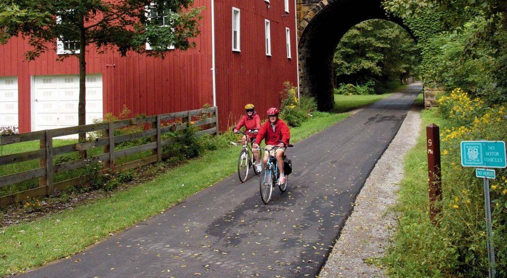
Ohio has many miles of biking trails developed from former railroad rights-of-way. Shown above is part of the Kokosing Gap Trail in Knox County. (Credit: Ohio.org)
Ohio has more than 1,000 miles of “rail trails” – former railroad rights-of-way that have been converted into bicycle and walking trails. The concept of reusing railroad trails for recreational purposes extends to using canalways, industrial sites and other former uses.
In addition to these trails, Ohio has many miles of city and state park trails and other pathways designated for multi-use including biking, electric bikes/scooters, inline skates and walking.
Here are the best ones in the state, according to the Rails to Trails Conservancy (railstotrails.org). You can find more information on these trails at their website.
Alum Creek Greenway Trail – 25.2 miles from Westerville to Three Creeks Metro Park near Groveport in Franklin County.
Great Miami River Trail – 93 miles along the Great Miami River in southwest Ohio from Piqua to Fairfield in Butler, Miami, Montgomery and Warren counties.
Heart of Ohio Trail – 20 miles of paved former railroad right-of-way connecting the towns of Mt. Vernon and Centerburg in Knox County. This trail is connected to the Kokosing Gap Trail and the Mohican Valley Trail. Together these trails are part of the Ohio to Erie Trail.
Hockhocking Adena Bikeway – 22 miles from Athens to Nelsonville in Athens County, running near both Ohio University and Hocking College in southeast Ohio.
Holmes County Trail – Two separate segments (7.3 miles from Gann to Glenmont and 15.8 miles from Killbuck to Fredericksburg) that accommodate horses and buggies as well as bicyclists. The trail ties into the Knox County trail system at Brinkhaven (Gann).
Kokosing Gap Trail – 13.4 miles connecting the towns of Mt. Vernon, Gambier, Howard and Danville in Knox County. This trail features park benches every half-mile, railroad artifacts, bridge crossings and more.
Little Beaver Creek Greenway Trail – 12.5 miles running alongside the Middle Fork of Little Beaver Creek in Columbiana County in northeast Ohio.
Little Miami Scenic Trail – 78 miles from Cincinnati to Springfield, this trail features an abundance of natural habitats, historic sites and connections to other bicycle trails.
Ohio & Erie Canal Towpath Trail – More than 90 miles from Cleveland to Bolivar, with plans to extend 11 more miles to New Philadelphia. This historic trail was formerly used by canal boat towing crews using mules in the 19th century and now traverses the Cuyahoga National Park area.
Ohio to Erie Trail – A 326-mile network of trails, some of them rail trails, that will eventually connect Cleveland (at Edgewater Park) and Cincinnati (at Smale Riverfront Park).
Summit County Bike and Hike Trail – 34-mile trail bordering Cuyahoga National Park and connecting to the Ohio & Erie Canal Towpath Trail.
Western Reserve Greenway – 43 miles through rural Ohio from Ashtabula to Warren, following Pennsylvania Railroad former branch line.
All rights reserved, copyright Dusty Tires (dusty-tires.com), 2024.
